The brief
Working alongside the Martha’s Vineyard Commission and the Nantucket Conservation Foundation, we conducted a 12-month-long habitat mapping project of Martha’s Vineyard.
Martha’s Vineyard consists of two islands off the coast of Massachusetts, which are very high profile and under development pressures (housing, transportation, infrastructure). The location also receives many summer visitors, up to 94,651 daily.
The client wanted to understand the impact of how these stress factors might have changed the location’s habitat and impacted its protected species since the previous habitat mapping exercise in the early 2000s.
What we did
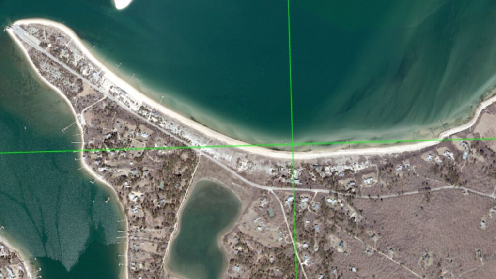
Our GIS and mapping team was desk-based in the UK and used aerial photography to map the two islands into very detailed habitat areas (0.25 acres units). We mapped nearly 40 unique categories of vegetation, including Black Oak, Scarlet Oak Forest Woodland and Cranberry Bog (which is a habitat of cultural importance to Nantucket Island).
We also used a series of manual data capture techniques and automated AI/Deep Learning strategies adapted to suit the unique circumstances of the island’s ecology.
Following this, we shared our geographical data through an online portal, and a large group of conservation volunteers ground-truthed it (checking the accuracy of our data through in-situ observations).
In return, our GIS and mapping specialists reviewed any queries raised by the local ground-truthing and updated the data in real time. This collaborative approach meant that we could quickly adapt our data collection methods to suit conditions on the ground.
Overcoming geographical challenges
Due to the five-hour time zone difference between the UK and Massachusetts, we communicated with the client at an optimum time, organising virtual meetings in late UK time (early morning in East Coast time).
In doing so, we fostered an excellent working relationship, discussed habitat mapping issues as they arose and were able to keep the project on track. This highlights our flexibility when working on projects across the world.
The outcomes of our habitat mapping
The project has enabled the client to understand habitat changes at Martha’s Vineyard across the last 20 years and to see which habitats face pressure from seasonal visitors and developments. In particular, our data revealed that many of the affected habitats, such as Martime Juniper Woodland/Scrubland and Sandplain Grassland, are very sensitive.
Many local stakeholders are keen to use the data for various projects and to identify areas of habitat at most risk or where improvements can be made. Moving forward, we are excited to explore the possibility of working on a ‘live’ vegetation map with potential updates over regular periods in the coming years.
For support on an upcoming habitat mapping project, or to enquire about our GIS and data capture techniques, get in touch today.
-
Martha’s Vineyard Commission and the Nantucket Conservation FoundationLocation
-
Martha’s Vineyard
Services offered"The quality of the work is amazing. The GIS and mapping team is incredible, and on-screen digitisation and AI classification are impeccable. Mapping nearly 40 unique vegetation categories down to a 0.25-acre minimum mapping unit is just an intense amount of work. “The Thomson GIS team followed through and delivered a stunning product. Many in the community and I are eager to use this data for a plethora of projects. Thank you!"Chris Seidel, GIS Coordinator, Martha's Vineyard Commission -
Our other projects
We cover all aspects of environmental consultation – from smaller surveys through to strategic projects.
At Thomson, we strive to deliver a pragmatic and innovative approach to environmental compliance.
Working in partnership with our clients, our team of environmental specialists ensures objectives are met, with maximum efficiency for our clients, and minimal impact on the natural world.
