Thomson Environmental Consultant’s marine team regularly conduct Intertidal Phase 1 walk-over surveys. These studies reveal key insight into development sites, including identifying important habitats and identifying any risks.
In this blog, we will explain key steps when undertaking an Intertidal Phase 1 Walk-over Survey, and how this information can be used to inform a Preliminary Ecological Appraisal.
Intertidal survey initial desk study
An Intertidal Phase 1 walk-over survey commences with an extensive desk study, where ecologists gather preliminary ecological data to form a foundational understanding of the site and surrounding areas. This includes identifying the presence of protected species and statutory designated areas of protection. Special Areas of Conservation (SACs), Sites of Special Scientific Interest (SSSIs), and Special Protection Areas (SPAs) are reviewed.
This preparatory phase is vital as it identifies local biodiversity surrounding the site, which may be impacted by proposed works. For instance, if dredging activities are proposed for a site, sediment dispersion may impact the surrounding area, not just the area directly within the site of works. Potential impacts and mitigation options can then be reviewed. For dredging activity, silt matting may be used to reduce sediment dispersion and minimise potential impacts on local ecosystems.
Survey Design
The determination of the Intertidal Phase 1 walk-over survey area is closely aligned with the scope of the proposed works. Typically, for small-impact zones, the survey area extends approximately 200 metres from the site to encompass all potential areas of influence.
It’s highly recommended that Intertidal surveys be conducted between April and October, as this is the period with the most faunal and floral growth on the shoreline.
Also, in order to survey the full extent of the Intertidal area, the survey should be completed on a Spring low tide, when tidal ranges are at their highest. Access to the survey site must be secured safely and efficiently. This involves liaising with key stakeholders, such as the harbour master and relevant governing bodies, to obtain the necessary licenses and permissions.
Ensuring compliance with regulatory requirements is paramount to facilitate smooth survey operations and uphold safety standards. Work is conducted on the ebbing tide to ensure there is always means of egress.
The Field Survey
Once the preparatory steps are completed, field surveyors complete the on-site assessment. Surveyors conduct a thorough examination of the sediment and conspicuous fauna to determine the biotopes present. This is completed following methodologies set out by the Joint Nature Conservation Committee, the Countryside Council for Wales, and the UK Habitat Classification (UKHab).
The objective is to identify and document the habitat within the survey area, noting any environmental sensitivities that could be impacted by the proposed works. Once the habitats have been identified, their conditions are assessed, and they are given a numerical score for use in subsequent Biodiversity Net Gain (BNG) calculations.
Reporting: Preliminary Ecological Appraisal
The desk study and phase 1 walk-over survey results inform a Preliminary Ecological Appraisal (PEA) report. Following nationally recognised habitat classification systems whilst conducting Intertidal Phase 1 surveys allows the DEFRA Biodiversity Metric for BNG calculations to be applied.
The habitats identified within the survey area are given a score based on metrics such as their condition, size, and level of importance for local biodiversity. These values are then used to calculate the number of habitat units present on a site.
This calculation provides a baseline to ensure that once a development has been completed, a net gain of habitat units has been achieved. BNG can be achieved in a variety of manners including improving other habitats on site, creating additional habitat area or investing in the management of similar habitats in other locations.
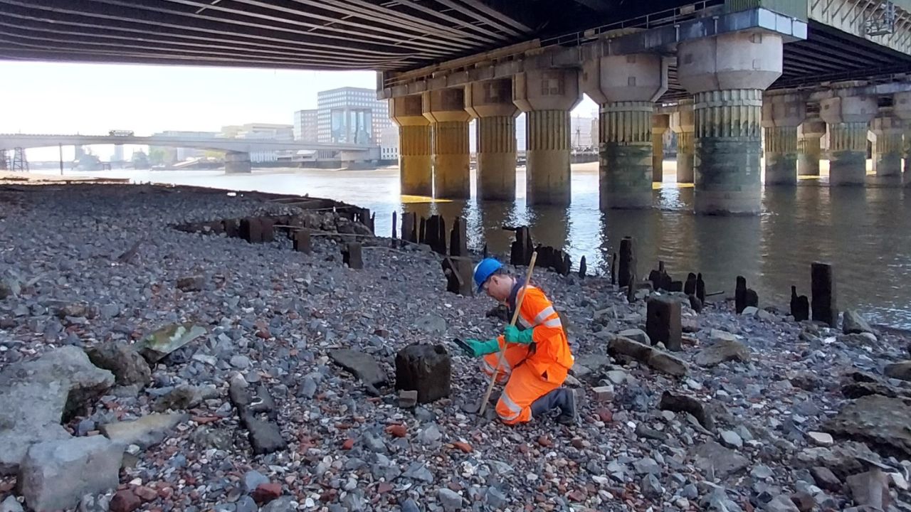
Phase 1 Walkover Survey at the River Thames
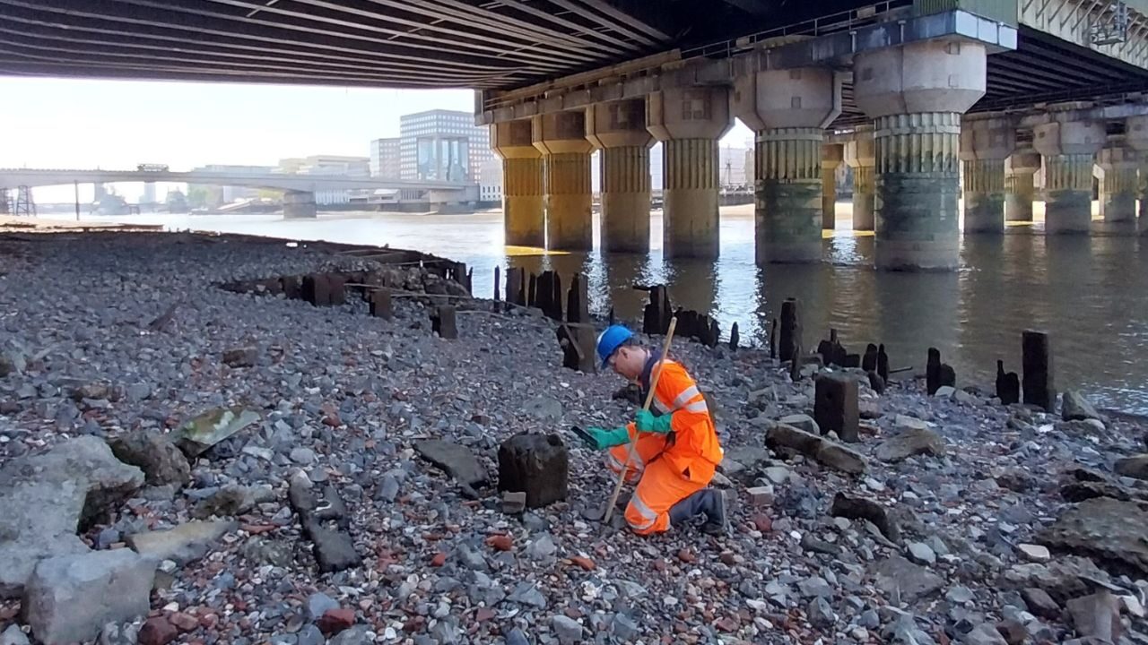
For example, our team have previously completed a comprehensive walkover of the site spanning a section of the River Thames. The survey delved into the layers beneath the cityscape of London to evaluate the environmental impacts associated with the river management.
Whilst the city’s dynamic pace overshadows the River Thames, it remains vital to protect ecological diversity. Even the smallest marine organisms play crucial roles within the intricate web of local ecosystems, underscoring the importance of environmental assessments.
How Thomson Environmental Consultants can support your next project
At Thomson Environmental Consultants we pride ourselves on our ability to deliver diligent environmental appraisals, supporting developments.
Get in touch if your project requires an Intertidal Phase 1 walk-over survey – it’s important to factor in the recommended timing of walk-over surveys at the planning stage to ensure your environmental assessments are compliant and your projects are delivered on time.
